📸 Flash Sale:
Free 8×12 Photographic Print
with Digital File purchase!
Photos
Products
Stories
Blog
About Us
Help
Sign Up
/
Sign In
Home
About Us
Photos
Products
Help
Blog
Stories
WRMcF
165 lifetime points
Joined 2019
0
albums
33
Comments
0
Likes
0
Geotags
Recent Activity
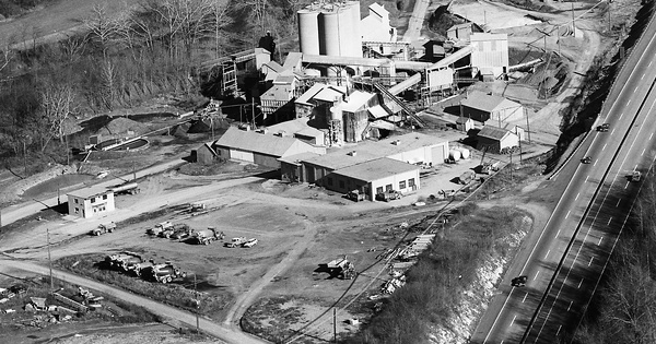
1974
Bedford County, PA
Commented
I can picture where this is. You're between the Breezewood and Bedford exits. If my memory serves me correctly the quarry was on the south side of the Turnpike, which would be to the left if one were headed westward toward Pittsburgh.
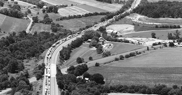
1994
Berks County, PA
Commented
Not to be a contrarian, but the traffic jam is headed in the eastbound direction. This photo is taken looking westbound toward Berks County, very close to the county line between Lehigh and Berks Counties. I travel that section of Interstate 78 regularly going in both directions.
Pre-1986
Monroe County, PA
Commented
As a follow on to my comment earlier, I checked on Google Maps and this building is now a tobacco store.
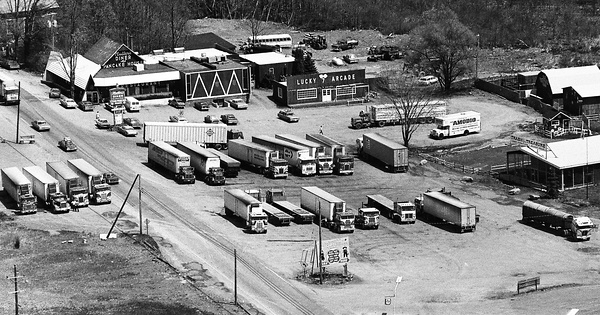
Pre-1986
Monroe County, PA
Commented
This was Muller's Diner on US 209 on the right side headed northbound, approximately 7 miles north of East Stroudsburg. Notice the many trucks in the photo. In the 1970s and the first half of the 1980s, US 209 between Interstate 80 and Interstate 84 was a trucker's shortcut for truckers traveling to and from Eastern New York State and New England. After the National Park Service took control of the Delaware Water Gap National Recreation Area US 209 was closed to truck traffic not originating in Monroe or Pike Counties. That happened in the middle to late 1980s.
Pre-1986
Monroe County, PA
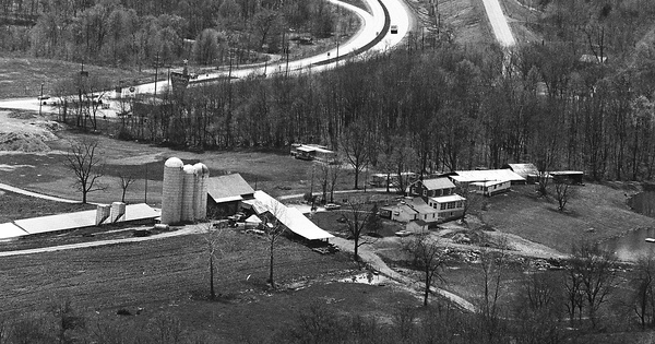
Commented
This is a closer view of Mosier's farm. Please see my comments at Photo 29 on this roll for greater detail.
Pre-1986
Monroe County, PA
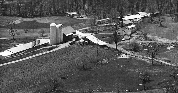
Commented
This was Mosier's farm and they had a convenience store which would have been at the lower left hand corner, just outside of the photo. We used to buy milk and groceries at the convenience store. The convenience store is now a Dunkin Donuts in the same building with some renovations being made. This photo shows Exit 309 on Interstate 80 where US 209 headed south/north merges into Interstate 80 headed east/west. This former farm is being converted into a mixed retail and residential development which should be completed within the next several years. There have been several plans over the past 20 or so years to develop this space which did not come into being for a variety of different reasons.
Pre-1986
Monroe County, PA
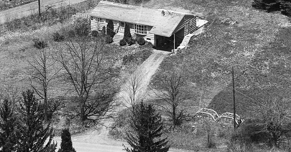
Commented
This home was at the intersection of PA 447 and Franklin Hill Road outside of East Stroudsburg. On PA 447 this home would have been on the right side headed northbound, approximately halfway between Interstate 80 and Eagle Valley Corners. Never knew any of the families that lived in this home. The home is still standing and the appearance is basically the same as when this photo was taken which was probably in the middle to late 1970s.
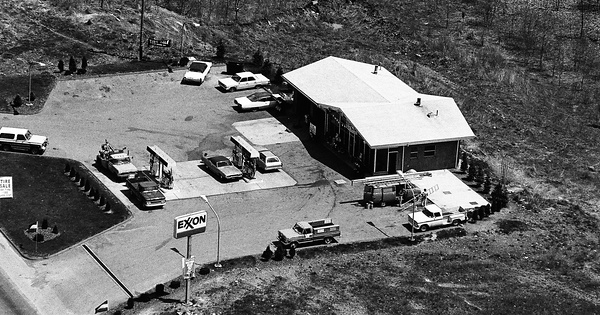
Pre-1986
Pike County, PA
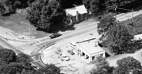
Commented
This Texaco gasoline station was at the intersection of US 209 and PA 739 in Dingmans Ferry, approximately 9 miles south of Milford. Where the gas station which was torn down in the middle 1980s stood is now a vacant lot. This photo is taken looking southbound. There is another photo of this Texaco station in the pre 1986 Pike County collection, looking northbound.
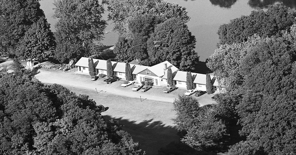
Pre-1986
Pike County, PA
Commented
This motel may have been the motel which was along US 209 approximately two miles north of Bushkill. If this is what I think that it was, it would have been on the right side of US 209 headed northbound. Again if this is what I think that it was, that is the Delaware River in the background.