Photos
Products
Stories
Blog
About Us
Help
Sign Up
/
Sign In
Home
About Us
Photos
Products
Help
Blog
Stories
AndyJ
18,287 lifetime points
Joined 2020
7
albums
1,055
Comments
2
Likes
3,253
Geotags
Recent Activity
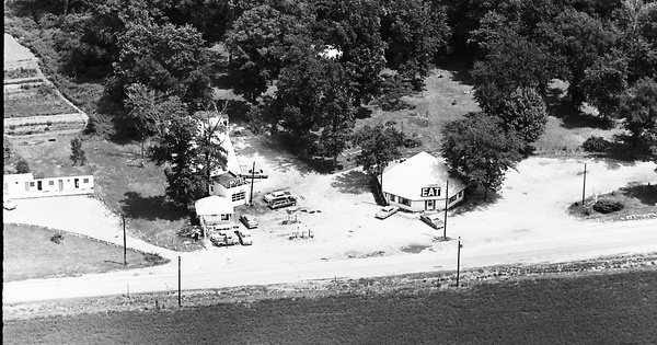
1968
Madison County, IL
Commented
The sign appears to read: Campus Queen along with a classic EAT neon sign. A filling and service station is visible equipped with both a garage and twin pump islands. Prior to 1968, the highway in the foreground was designated as Bypass US 40 & Bypass US 66. The junction of these two highways occurred less than a 1/4 mile east in a triangular interchange with 40 coming from the south and 66 coming in from the north. By 1968, I-270 had been constructed, the triangular interchange had been removed and all US highway designators had been dropped from the pavement in front of the complex. Another, and likely separate motel complex appears at left.
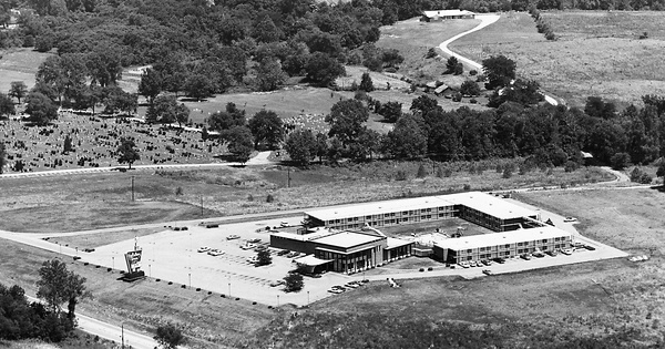
1968
Madison County, IL
Commented
Pinned location is 3080 S State Rte 157, Edwardsville, IL 62025. The hotel complex appears to have been completely demolished around 1998. The Comfort Inn Edwardsville is now located there. Calvary Catholic Cemetery is visible in the background. It is said that back during the Mississippi River Festival (music festival) days held at SIUE, the Holiday Inn was where many of the touring acts stayed when they came to town to perform.
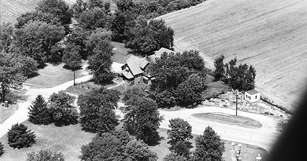
1968
Madison County, IL
Commented & Pinned
At the time of this photo, the highway in the foreground had recently become State Highway 157. Prior to that, it was designated as Bypass US 66. Pinned location is 2995 S State Rte 157, Edwardsville, IL 62025. Directly across the highway from the house is Calvary Catholic Cemetery. The monument business is no longer there and much of it and the front yard of the house were sacrificed for the widening of 157. Across from the monument lot is the entrance to Sunset Hill Memorial Estates. View looks NW.
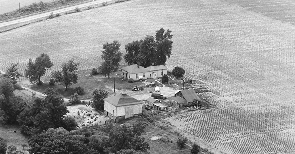
1968
Madison County, IL
Commented & Pinned
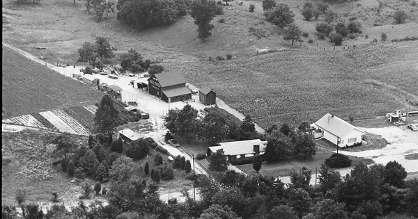
Pinned location is approximate as nothing remains of the farmstead today. Note the unique square barn with copula. The Norfolk and Western (previously the New York Chicago and St. Louis) RR tracks are at the top of the photo. There are two sets of RR tracks seen, with the second set being a siding which began just east of where the lane crosses the tracks. This siding appears to have been short-lived since the 1954 and 1968 topo map shows only a single set of tracks at this location. Aerial photography from 1955 doesn't appear to show the siding. However, it is visible in the 1962 and 1968 aerial photos. View looks SSW.
1968
Madison County, IL
Commented & Pinned
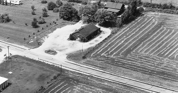
Same farmstead as featured in photo #24. At the time of this photo, the highway in the foreground had recently become State Highway 157. Prior to that, it was designated Bypass US 66. Nothing remains of the farmstead at center. The Chicago and Northwestern RR tracks are just barely seen through a break in the trees at upper right. The tracks were later abandoned and turned into the Quercus Grove Trail. View looks NNW.
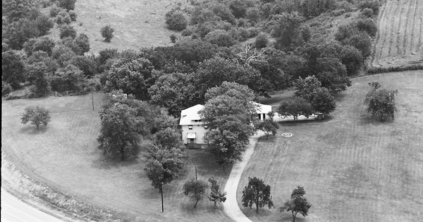
1968
Madison County, IL
Commented & Pinned
State Hwy 157 is at lower left. Prior to 1968, it was designated as Bypass US 66. Pinned location is 4572 Old US Rte 66, Edwardsville, IL 62025. View looks ESE.
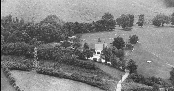
1968
Madison County, IL
Commented & Pinned
The electrical transmission towers near the bottom parallel the Illinois Terminal RR tracks. Pinned location is 1004 Hillsboro Ave, Edwardsville, IL 62025. View looks SE.
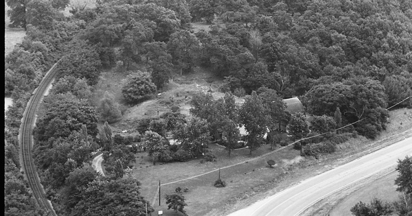
1968
Madison County, IL
Commented & Pinned
At the time of this photo, the highway at left had recently become State Highway 157. Prior to that, it was designated Bypass US 66. Nothing remains of the farmstead at center. The Chicago and Northwestern RR tracks at left were later abandoned and turned into the Quercus Grove Trail. View looks NNE.
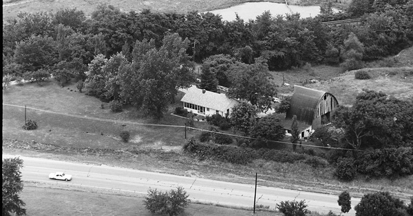
1968
Madison County, IL
Commented & Pinned
Note the Mail Pouch Barn just left of center. At the time of this photo, the highway in the foreground had recently become State Highway 157. Prior to that, it was designated as Bypass US 66. Pinned location is 4506 IL-157, Edwardsville, IL 62025. View looks ESE. The house in the bottom center has been added onto considerably. All outbuildings in the rear of it are no longer there. The house on the right is still standing. The electrical transmission towers at the top of the photo parallel the Illinois Terminal RR tracks.
1967
Montgomery County, IL
Commented & Pinned
Pin location adjusted. View looks SW.