

Join Our Community
34,087 members are helping us to bring our collection to life.
Create a free Vintage Aerial account now to start commenting on photos, pinning locations, and earning points redeemable for our products!
Sign up now and receive a coupon for 10% off your first order!
Comments
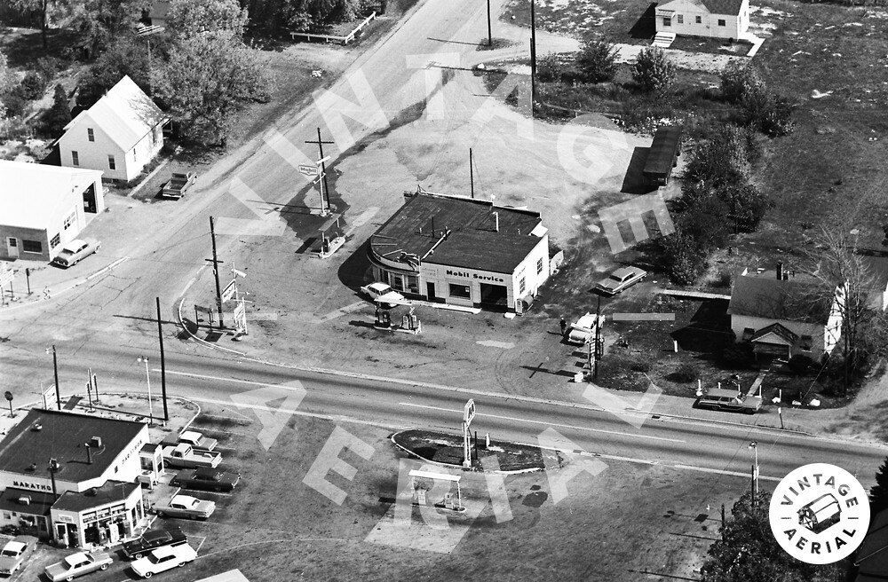
Looking east into unincorporated Williamstown, Ohio. The main road seen is U. S. Route 68. The east-west cross road is the original alignment for the Lincoln Highway, U. S. Route 30. Seen in the photo are a Marathon and Mobil service station. Only the building, and white house, seen in the northeast corner of the intersection, survive today.